Share Campbelltown Southern Catchments Flood Study on FacebookShare Campbelltown Southern Catchments Flood Study on TwitterShare Campbelltown Southern Catchments Flood Study on LinkedinEmail Campbelltown Southern Catchments Flood Study link
Consultation has concluded
Why a flood study?
Flooding is the costliest form of natural disaster in Australia but also one of the most manageable natural disasters as we can reasonably predict which areas it will impact.
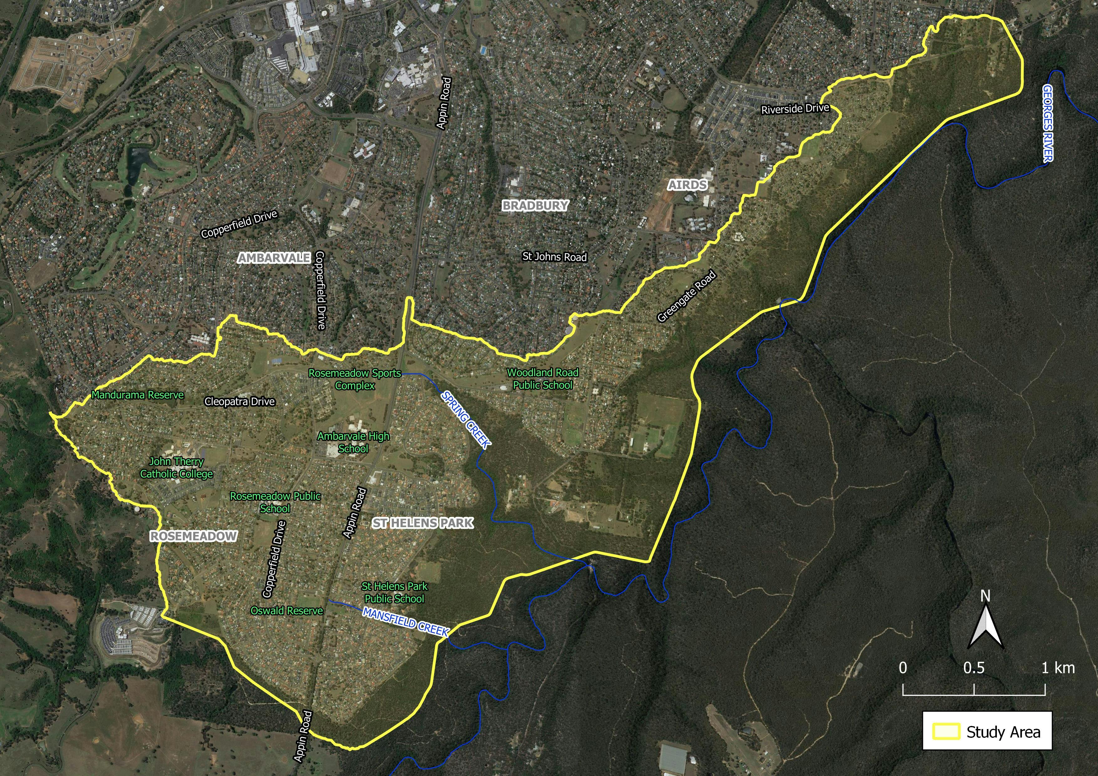
To better understand and manage the existing flood risks, we are preparing a flood study for the Mansfield Creek and Spring Creek catchments as well as several smaller tributaries that drain into the Georges River (collectively referred to as the Southern Catchments). The study area includes sections of Airds, Ambarvale, Bradbury, Rosemeadow and St Helens Park.
The preparation of this flood study will enable key flooding characteristics such as floodwater depths and speed to be established across the study area, allowing us to confirm the location of flooding problems and identify where flood mitigation measures (e.g., stormwater upgrades) may be best implemented to reduce the impact of flooding on the community. It will also assist with emergency management and guide future development and re-development so that it is compatible with the flood risk and does not create additional flooding problems in the future.
How you can Help
The flood study will include the development of a computer flood model to simulate a range of flood sizes. To ensure the computer model is providing a reliable description of flood behaviour, the model will be validated against historic flood information at various locations.
By participating in the questionnaire you will help us to collect as much historic flood information from the community as possible to assist with the computer model validation.
Submissions will be accepted up to 27th August 2021.
(Click Image to Enlarge)
Why a flood study?
Flooding is the costliest form of natural disaster in Australia but also one of the most manageable natural disasters as we can reasonably predict which areas it will impact.
To better understand and manage the existing flood risks, we are preparing a flood study for the Mansfield Creek and Spring Creek catchments as well as several smaller tributaries that drain into the Georges River (collectively referred to as the Southern Catchments). The study area includes sections of Airds, Ambarvale, Bradbury, Rosemeadow and St Helens Park.
The preparation of this flood study will enable key flooding characteristics such as floodwater depths and speed to be established across the study area, allowing us to confirm the location of flooding problems and identify where flood mitigation measures (e.g., stormwater upgrades) may be best implemented to reduce the impact of flooding on the community. It will also assist with emergency management and guide future development and re-development so that it is compatible with the flood risk and does not create additional flooding problems in the future.
How you can Help
The flood study will include the development of a computer flood model to simulate a range of flood sizes. To ensure the computer model is providing a reliable description of flood behaviour, the model will be validated against historic flood information at various locations.
By participating in the questionnaire you will help us to collect as much historic flood information from the community as possible to assist with the computer model validation.
Submissions will be accepted up to 27th August 2021.